Expert Q&A: Dr. Dale Vitt
By Amy Nelson
Dr. Vitt’s research, which continues to inform the study and restoration of peatlands, has been supported by the Natural Sciences and Engineering Research Council of Canada (NSERC), the National Science Foundation (NSF), industries, provincial governments, and NGOs. He has served on NSERC and NSF panels, as Editor-in-Chief for The Bryologist for 10 and as an officer of the International Association of Bryologists. His edited books include Boreal Peatland Ecosystems (with Kel Wieder, published by Springer) and Reclamation and Restoration of Boreal Ecosystems (with Jag Bhatti, published by Cambridge University Press). Dr. Vitt’s current research interests include responses of communities to natural and man-made disturbances.
For people who are not familiar with peat, what is it?
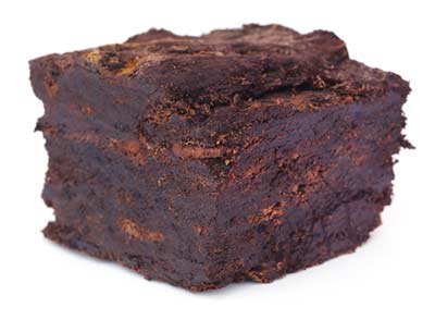
Peat is essentially undecomposed remains of plants. A peatland is an ecosystem in which the production of biomass by photosynthesis is greater than the decomposition of that biomass by decomposers. When this takes place, organic matter accumulates. Over a very long period of time, we end up with deep deposits of this organic matter, and that is peat. A peatland is one of very few ecosystems that, over a long period of time, has more inputs than outputs.
Why are peatland ecosystems so effective at storing carbon?
That is a great question. The real key to the existence of peat—and the controlling factor–is they do not have much decomposition. Although temperature can be a factor, because decomposition decreases when it’s cold, the key reason peat exists is anaerobic conditions. The top of a peat column—from the first few inches down to as far down as a foot or so—is aerobic. There is oxygen there, and that is where the decomposition takes place. The longer peat stays in that aerobic zone, the more decomposition takes place.
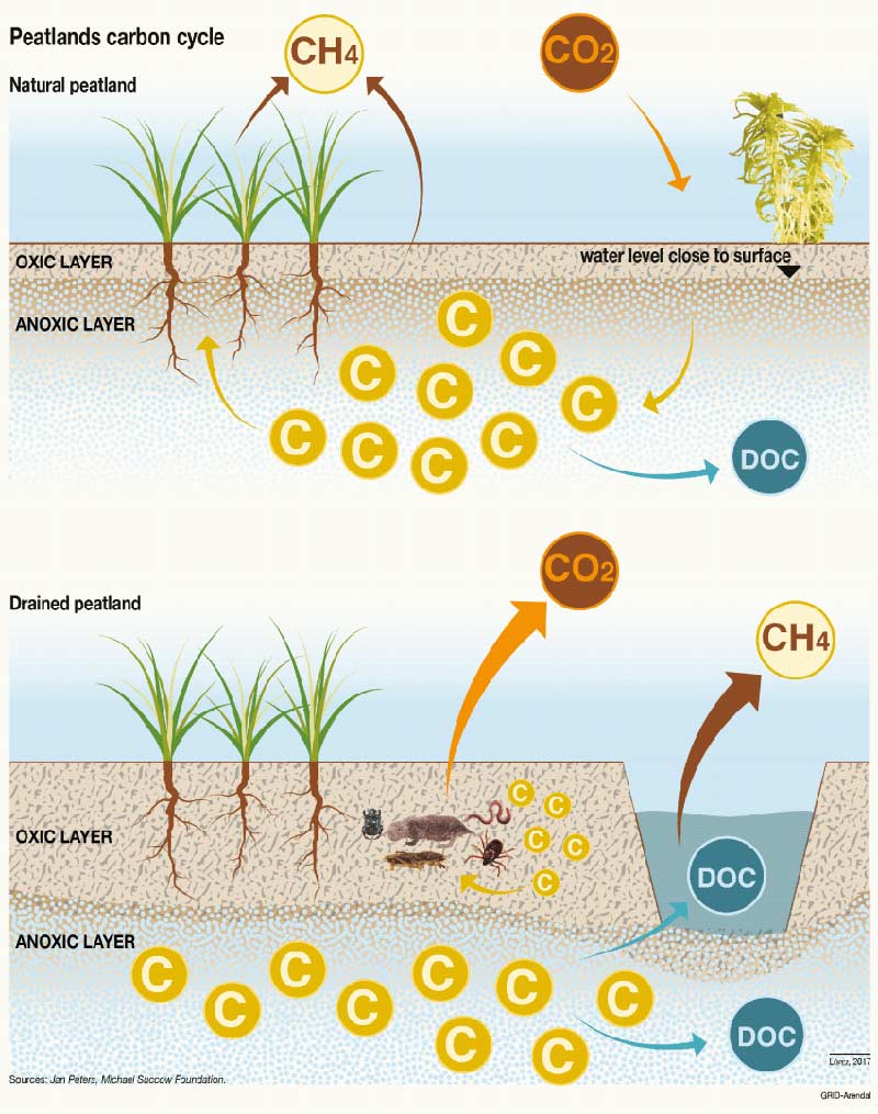
As time goes on and the peat column grows, that particular cohort of peat reaches the anaerobic zone, and at that point, decomposition essentially stops. In other soils, the aerobic zone continues down through the soil column. You don’t get a waterlogged, anaerobic zone in mineral soils, for example. The key to producing peat is to have waterlogged, anaerobic conditions that retard decomposition rates.
Generally speaking, how old are the oldest peatlands?
Somewhere between 10 and 13 thousand years ago, glaciers moved southward and removed everything from the northern boreal zone, so there couldn’t be any peatlands there from before that time. You might then think that if you go south of the glacial border, like somewhere in the United States that wasn’t glaciated, you’d find peatlands older than 10 to 13 thousand years old, but you don’t. All peatlands seem to be, at maximum, from about 10 to 13 thousand years ago. That includes tropical peatlands.
Peatlands are very affected by climate. Were there peatlands before the last ice age? Maybe. Maybe not. Maybe these are phenomena that come and go with ice ages. We do not know.
How do peatlands form and how long can it take for them to form?
It takes a long time—hundreds of years—for peatlands to form. Peatlands can form in three ways. Bodies of water can become gradually filled in, and this is called terrestrialization. This is the case with kettle hole bogs in Ontario, Michigan, and New York, where steep-sided depressions left after glaciation filled in and over time, formed peatlands. People used to think this was the common way peatlands were formed, but if you core peatlands, you see that terrestrialization is actually not very common.
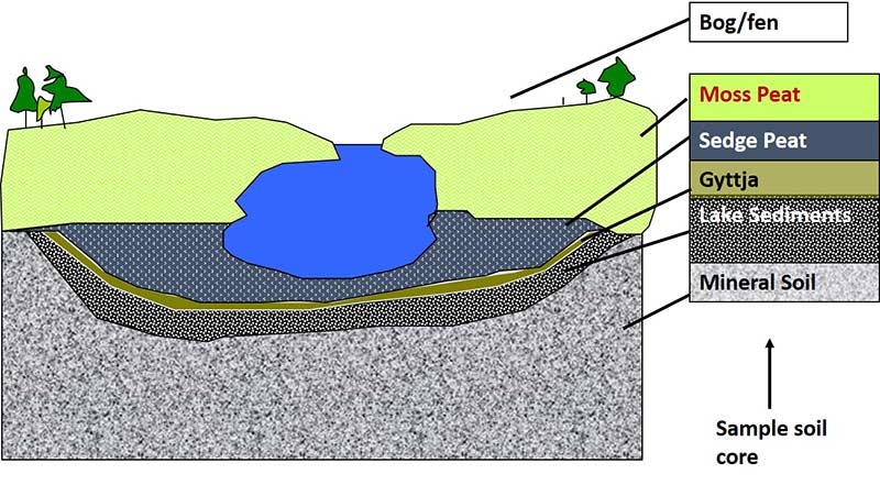
A more common way that peatlands form is paludification, or swamping. Paludification starts with a mineral soil that is very dry and has trees growing on it. Then, as climate changes, regional water levels rise. As the water levels rise, you get this anaerobic surface, which kills the trees and allows peat to start forming. Ninety percent of the peatlands in western Canada are formed by paludification.
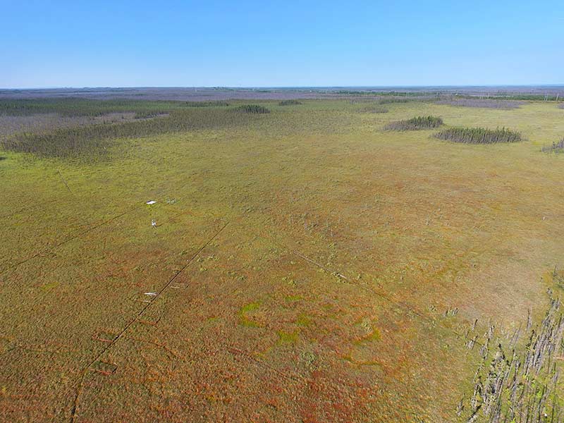
The third way that peat forms is called primary peat formation. After glaciation, there were shallow, proglacial lakes that formed. At the base of those lakes, the sedimentation formed lake clays, and those clays formed an impervious layer. After the lakes dried up, about seven or eight thousand years ago, peat formed on substrates that didn’t have any previous vegetation. The same is true for areas that have risen from isostatic rebound exposing fresh un-vegetated surfaces (like south of Hudson Bay).
Dr. Hans Joosten talked about the differences between boreal and tropical peatlands. But can you give us a very general overview of the different kinds of peatland ecosystems (bog, fen, swamp) and the different plant communities found in each?
If you look at boreal systems, there are two types of peatland: fens and bogs. They are defined hydrologically. Bogs receive all of their nutrients and water supply from precipitation and they are hydrologically isolated from the surrounding upland areas. Fens receive their nutrients and water from precipitation, but also from water that has flowed over the surrounding uplands [via groundwater and overland runoff]. Fens are flow-through systems, whereas bogs are systems in which water can only flow out. Bogs are referred to as ombrogenous because the atmosphere is the source of their water. Fens are referred to as minerogenous, because they have mineral sources to their water. Both fens and bogs have very few nutrients, but since fens are a flow-through system, they have access to more nutrients than bogs. So generally, plant production is a little higher in fens than it is in bogs. Swamps (with trees) and marshes (with no trees) are non-peat forming wetlands that have less than 40 cm of peat.
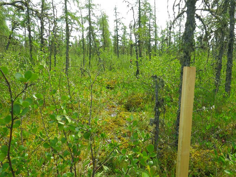
Bogs are very acidic, and they are so for two reasons. First, Sphagnum produces acidity. Second, some of the acidity comes from decompositional processes. Fens can be acidic or quite calcareous. Acidic fens, which are dominated by Sphagnum, are called “poor fens.” The point where poor fens become rare on a pH scale is above a pH of 5.5. Above pH 5.5, there is not much Sphagnum in the system, because Sphagnum doesn’t tolerate alkalinity, and other mosses take over. Those mosses are generally called brown mosses because they are brown in color. Brown mosses don’t produce much acidity, so with the influence of calcareous groundwater, these systems become quite alkaline. These are called “rich fens.” They are called “rich” because they have many species that have high fidelity. In poor fens there are fewer species with high fidelity. Rich fens may also be a little more nutrient rich than poor fens.
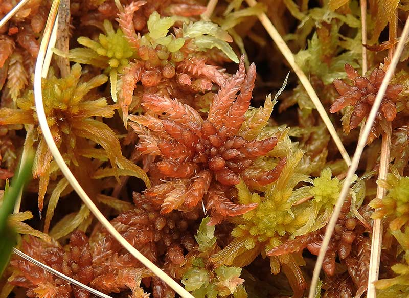
On a pH scale from 3-8, bogs are 3-4, poor fens are 4-5.5, and rich fens are 5.6-8. All of these systems can have trees on them. All can have shrubs. Some can have just sedges, and some can have just mosses. The structure of the vegetation can be variable, but the ground layer-the moss layer-is always abundant. So, one can identify bogs and fens not by whether or not they have trees on them, but what the species of moss are.
If you take a bag full of mosses (Sphagnum or brown mosses) and a bag full of vascular plants, place both bags in a peatland, and look at the rates of decomposition, you will see that after about two years, the mosses will have decomposed 10-20% while the vascular plants will have decomposed 50-60%. The rate of decomposition is so much lower with mosses, and that is why they are so important in peatlands. They are what makes up most of peat. If you look at a 5,000-year-old peat column, much of the peat will be composed of dead mosses, not dead vascular plants. Bryophytes [the group of plants that includes mosses] are the major peat formers.
Is there a particular peatland plant you find most fascinating?
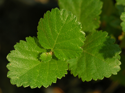
All mosses are beautiful, but there is a vascular plant that is a favorite of mine because its common name is a bit of a misnomer and that amuses me. One of the dominant shrubs in peatlands is birch. White birches are the trees with the white trunks, but there is a whole group of shrubby birches, and they occur largely on organic soils in the Arctic, the boreal zone, and in peatlands. Two of those species are sometimes lumped together (Betula glandulosa and B. glandulifera) and their common name is “bog birch.” It turns out, however, that bog birch is actually an indicator of fens. If you have even one bog birch on a peatland, you are not in a bog; you are in a fen.
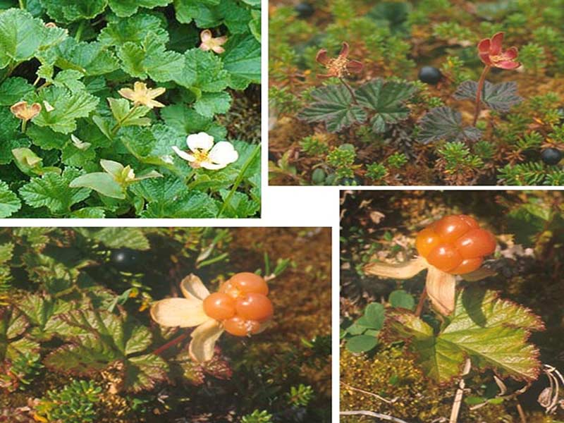
I also like two species of the Ericaceae family of plants that only occur in bogs: cloudberry (Rubus chamaemorus) and lingonberry (Vaccinium vitis-idaea). They both make great liqueurs and jams. Lingonberry is the classic Swedish jam that goes with Swedish meatballs.
Obviously, dry and/or aerobic conditions are limiting factors for peatlands. What is another limiting factor?
One of the key problems in oil sands areas, and in many peatland areas in Europe, is the addition of nitrogen to peatlands. Nitrogen is a key limiting factor. Bogs and fens naturally occur in areas where there is not much nitrogen deposition. In agriculture, if you add nitrogen, plants grow more and you get more biomass. Bryophytes decompose very slowly, and vascular plants decompose relatively fast. When nitrogen molecules fall on peatlands, they are absorbed by the mosses, which are on the surface. The roots of the vascular plants can’t get to the nitrogen. The only way the vascular plants can get the nitrogen is through the decomposition of the moss plants. For that reason, mosses, especially in peatlands dominated by Sphagnum, have been called the “gatekeepers” of nitrogen. But if you add lots of nitrogen to the peatland, the mosses can’t absorb it all and it goes through the moss layer. Now, the roots of the vascular plants can get it, and they grow. As they grow, they start to shade out the mosses, and the system changes. We now have much more vascular biomass, and much less moss.
I know that ditching and draining peatlands for agriculture is harmful to peatlands, but does that mean that fertilizers used in agriculture also degrades adjacent or nearby peatlands?
Very much so. As soon as nitrogen-rich fertilizer drains onto the peatland, that is going to affect the peatland.
Peatlands are drained for a number of reasons (oil/gas extraction, agriculture, forestry, development, infrastructure). Generally speaking, what reason do think poses the greatest threat to the world’s peatlands?
It depends on where you are. Any time you drain peatlands, you lower the anaerobic zone and you expose peat that has been in that zone for a long time to aerobic conditions. When you do that, decomposition takes place very fast, and the peat column will degrade downward as you lower the water table.
Peatlands in the boreal zone are carbon sinks. They take out more CO2 from the atmosphere than they release. But very small changes on a landscape can make a peatland change from a sink to a source. There are lots of ways you can store C02. You can put it in the bottom of a lake in lake sediment, or you can put it in calcareous rock, and it will likely be there forever. But peatlands are different. They contain lots of carbon, but they are very sensitive to climatic changes and disturbances. The amount of carbon stored in boreal peatlands is roughly equivalent to the amount of CO2 currently in the atmosphere. Papers about peatlands often state that if you release all the carbon in peatlands in the boreal zone you’d double the amount of CO2 in the atmosphere, and that’s probably true. But any small change or disturbance, such as drainage or nitrogen additions, can change that balance and cause a peatland to go from being a sink to a source.
A few years ago, our group at SIU, along with our co-investigators from Villanova University (Doctors Kelman Wieder and Melanie Vile) determined that the frequency of wildfire is very important to peatland bogs in western Canada. When a fire comes into a bog, the first thing it does is remove all the plants. When that happens, the plants and peat that burn release CO2 into the atmosphere. In addition, the burned peatland will not sequester carbon for a certain number of years because all the plants have been removed. They have to regrow and succession has to take place in order for the peatland to become carbon sequestering ecosystem again.
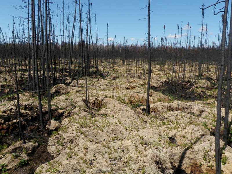
The fire return interval for peatland bogs in western Canada is about 115 years, meaning on average each bog will burn every 115 years. We determined that if you increase the fire interval by 17%, which would decrease the number of years in between fires to about 90, those peatlands will go from a sink to a source. We determined that it takes about 80 years for a bog to return to being a sink after wildfire. It will continue to be a sink for about 35 years, until the next fire comes along. But if the fire interval increases because of climate change, the peatland bog may only be a carbon sink for 20 years. If the fire return interval increases to the point where fires occur every 80 years, that peatland will never be able to recover from the last fire. Line Rochefort and others have found similar results in studying other types of disturbances, such as drainage. Peatlands are sensitive ecosystems in which little changes can cause big changes in carbon sequestration.
In general, what do we know about the impact of climate change on peatlands?
That is a very complex question, and the answer depends on what the changes are in a particular area. If climate change is going to make the boreal drier, then wildfires are going to increase and water tables are going to decrease. That means more aerobic zone and more decomposition. On the other hand, if it gets warmer, the plants will photosynthesize more and create more biomass. But the decomposition is also temperature-related. The tradeoffs are very complicated. Essentially, if it’s drier and hotter, peatlands are not going to be happy. But it is not clear to me that the boreal is going to be drier. It may be wetter in some places. To me it is unclear.
You mentioned Dr. Line Rochefort. In my interview with her, she said, “I believe all peatlands can be restored, regardless of the type of disturbance,” but she went on to say that when dealing with open pit mining, it becomes much more difficult. First of all, do you agree? Tell me about what you have learned in your recent work restoring fens on areas where open pit mining of oil sands has occurred.
I would agree with Line, but with the caveat that I’m not sure they can all be restored back to the peatland type they were originally. This relates to a government regulation issue. In the restoration oil sands sites in Alberta, government regulations say that we should strive for “equivalent capability,” meaning we should put back on the landscape what was there before it was disturbed. That sounds fair, but “equivalent capability” is not precisely defined. In northern Alberta, approximately 40% of landscape is composed of wetlands. Of those wetlands, almost all are peatlands while only a few are mineral, non-peat-forming marshes and swamps. So if you disturb a peatland but the “equivalent capability” is simply to return wetlands back to the landscape, you can technically return a non-peat-forming marsh or swamp [and still be in compliance with the regulation].
Fifteen years ago, everybody said that peatland restoration of open pit oil sands mining was not possible. Oil sands are located deep beneath overburden (regular soil). On top of that soil, the landscape is a mosaic of peatlands, a few marshes, and a variety of upland systems. To make an oil sands mining pit, the oil companies first dewater the landscape by putting ditches in. They then strip off the trees and the surface deposit, which includes the peat. They, then go down 50-100 meters, remove the overburden, and mine the oil sands. They take the oil sands to a refinery, where they remove the oil from the sand. In that process, they use a little sodium hydroxide -a saline solution. When they are done mining, they leave a big pit called an “in-pit.” When they have removed the oil from the sand, they dump the sand back in the in-pit and what is left is a 100-meter in-pit full of sodium-rich sand with nothing else on it. How do you take that surface after mining, and create a landscape that would have that mosaic of wetlands (including peatlands) and uplands?
Back then, it was assumed that the best you could do was possibly create some saline marshes, which are very rare on the Alberta landscape. There were lots of discussions, and finally two major oil companies, Syncrude and Suncor, decided to give it a try. They wrote into their operational plans that they would try to build a fen. Syncrude engineers, in collaboration with hydrogeologists from the University of Alberta, were charged with building a system that would be self-sustaining in terms of water, and our group was tasked with figuring out how to restore vegetation to the site. Suncor was doing something similar. My view was that the system was so harsh that mosses would not be able to survive at the beginning, so we needed to find plants that would grow on such a surface. We did a large number of greenhouse experiments to see what would grow under conditions such as high sodium concentrations, and we selected some plants. One particular sedge, Carex aquatilis ended up being a key species with broad tolerances to water levels and sodium.
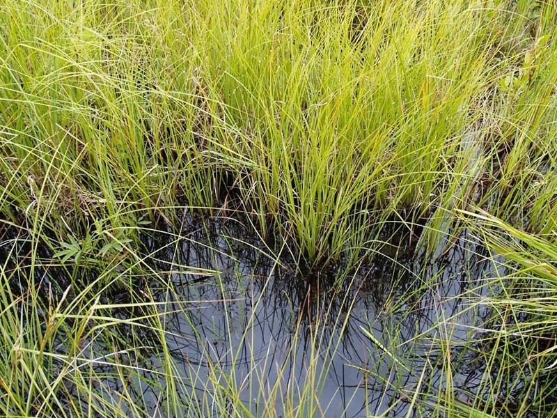
Syncrude built Sandhill Fen, a 17-hectare fen, in a basin that had water running through it that could be controlled. They placed impervious material on top of the in-pit sand to prevent the sodium from coming up, and on top of that, they placed peat. Then, we planted the plants. The fen was designed as a slightly concave bowl so when water goes through it, it is drier at the edges, medium at the middle, and wet in the center. It has been eight years since the fen was created. What we ended up with is a cattail (Typha) community in the center of the site. Cattail plant communities do not form peat; they form marshes. Decomposition rates in cattail marshes are so high that peat deposits never form. They are the bane of peatlands. Outside of the cattail zone, there is a really nice, Carex aquatilis-dominated fen that looks like it is now producing some carbon layers underneath it. In the outside portions of the fen (which we realize in hindsight, is too dry) there is a grass-dominated zone that will probably eventually become riparian areas with trees. If you calculate this all out, the site is about 15% cattail, 45% fen, and 40% grasses. There is a sweet spot where there seems to be very successful growth of Carex aquatilis and nice diversity of mosses (which came in on their own). My opinion is that there will be some sort of sedge-dominated community that will, over the next decade or so, maintain itself and have some similarity to a rich fen.
There are some problems, though. Everyone thought the engineers had designed the system so that the sodium would not be a problem, but it is. In some areas of the fen, the surface water has very high concentrations of sodium. Bryophytes cannot grow in high sodium areas; they grow only in high calcareous areas. All of the rich fens in Alberta have high concentrations of calcium and magnesium and very low concentrations of sodium. If you add sodium to a fen, the mosses die. Remember: mosses form the majority of the peat column, so if you don’t have mosses, you don’t have as much peat. The areas of high sodium at Sandhill Fen are a problem. We are just going to have to see whether it flushes out of the system. Sodium is a real issue on the in-pit surfaces of the open mine areas of oil sands.
What about restoring peatlands that have been degraded by the placement of well pads for oil and gas extraction? In 2010, you co-authored a paper in Ecological Engineering about a study you initiated to determine if, by emulating paludification, you could reestablish wetland function and structure where peatland soils had been altered to accommodate oil and gas well pads. What did you learn, and has that knowledge since been applied to restoration?
There are a number of different types of pads. For the type we were working on, the oil companies dump a meter or two of mineral soil on top of the peatland, [set up their well,] pump oil for 20 years and then leave. What we’re left with is a mineral soil pad in the middle of a peatland. In our study, we wanted to dig the mineral soil down to be at the water level of the surrounding peatland and plant–regardless of the type of peatland that surrounded the pad–fen plants and see if they could grow. We used the same plants we used at Sandhill Fen—including Carex aquatilis and willow bushes (Salix lutea) and tested a variety of treatments and amendments. It has been about 12-13 years since we did that. I visited the site two or three years ago, and the Carex aquatilis expanded quite nicely, and there are mosses underneath. The advantage of Carex aquatilis, is that it will grow on both organic and mineral substrates, so it can make the transition from mineral to organic base.
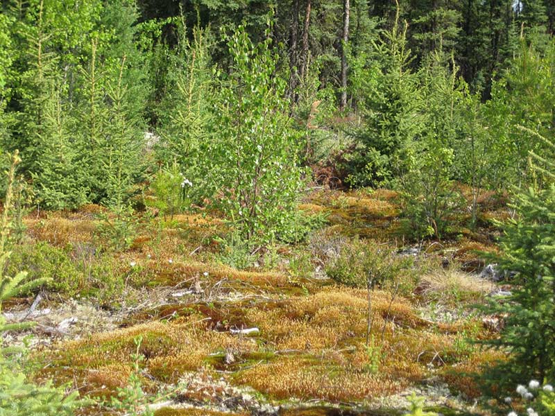
Line Rochefort has used another method [to restore peats degraded by well pads]. Underneath the mineral pad is very nice peat. Line’s approach was to make the well pad sites like a bog, so she got a big machine and inverted the soil so that the peat was on top and the mineral soil was underneath. Then, she had a peat surface on which to plant plants and allow the peat to accumulate. Two years ago, I visited at both sites, and they both work. A former student of mine is currently studying both sites and he, too, is finding that both approaches work. The good news is that you can, if you have money, recolonize these mineral substrates.
I have no reason not to be hopeful.
Last year, we did an issue about thawing permafrost. Is there any relationship between thawing permafrost and peatlands?
I’m glad you asked. In the boreal zone, there are peatlands that have permafrost that developed during the Little Ice Age. During the Little Ice Age, permafrost expanded southward—especially in bogs–about 200 kilometers. That permafrost is now thawing. My group discovered, mapped, and wrote papers about this zone of thawing permafrost in bogs. In the subarctic, when you have organic soils that have bogs, you get these islands or peninsulas called peat plateaus, and they are completely underlain by permafrost. If you go farther south, those bog landforms are warm enough that only parts of them have ice. The parts that have permafrost are melting. On these islands in the boreal forest, you end up with areas in a bog that never had permafrost, areas that still have permafrost, and areas that had permafrost that has thawed. When permafrost comes into a bog, ice expands and that raises the surface. That raised surface then becomes drier relative to the rest of the bog, the Sphagnum layer is mostly lost, and the trees will grow somewhat more than areas without ice. When permafrost thaws, those areas collapse and then go underneath the water and become rewetted. If they are in bogs, Sphagnum colonizes the thawed depressions and produces considerable new biomass when it is wet. The amount of carbon that is sequestered as a result of the permafrost thaw is greater than the amount of carbon that was being sequestered before the thaw! Over the next hundred years, these melted areas gradually succeed back into a typical bog. Over that hundred years, there will be more carbon sequestered than there was before the melt. So in the boreal, the response, in terms of carbon sequestration in these land forms, is kind of the opposite of what you have with permafrost thaw in the Arctic.
If a big pile of money dropped into your lap and it had to be used for research, what would you study? What research do you think is most urgently needed?
We are still not able to model and predict what happens when disturbances take place in a peatland. We need a model that links hydrology, vegetation, and ecological science. I also think we need to better understand ecosystem processes within a peatland. There are lots of discoveries yet to be made.
You have had a long career as a researcher and educator, and you have mentored many a graduate student. Since you began your career, have you seen a change in the level of interest in this study of peatland ecology?
For so long, peatlands were not given much respect. For example, 40 percent of Alberta’s forested land is peatland, but until recently there has never been a peatland expert in the Alberta Government. I have never understood how the provincial government could make land use decisions based on 60 percent of the landscape.
But there are more people working on peatlands now than ever before, some really great work is being done, and more money has become available for peatland research and restoration. I have no reason not to be hopeful.
